|
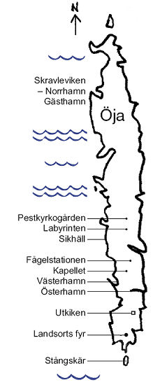
Öja is a long narrow island, located in north-south direction. The island is approximately 4.25 km long and 600 meters wide at most.
A port in the north (Norrhamn or Skravleviken), this is the island's guest harbor. The village (Storhamn) is located on the south of the island, here are two ports, one on the east side (Österhamn), and one on the west side (Västerhamn). Västerhamn used mostly of pilot boats and boats with Landsort to home port.
It is not allowed for pleasure boats to dock in the Västerhamn
Parts of the island from the village and north is dense forest with scrub. The island's forests consist largely of deciduous forest. The most common tree species are birch and alder.
Pine and spruce is limited to a small area on the island's internal parts. In addition, there are plenty of swamps, quagmire and marsh plants. There are rare orchids and other botanical rarities as whitebeam, arctic raspberry and yew.
Landsort (Öja) is an Environmental Protection Area. Dogs must be leashed throughout the year. Protect animals and birds, were extra careful in spring when it is very common eider and other birds that nest.
Today, living here about 30 people. Also a larger number of guests who have their second homes here, they go out here year round, mostly on weekends and longer leave. The majority of those who have second homes has had relatives who lived and worked on Landsort a long time.
The sedentary children commute on weekdays to schools in Nynäshamn and Ösmo. School of Landsort ceased in 1983.
In august 2006, Landsort was connected to the internet via fiber drawn from Torö (funded by Nynäshamns Municipality), which is good for Landsort, both for permanent residents and summer visitors. This means that those who work with the help of broadband may be out for longer periods, and some may move out here permanently.
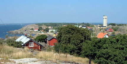
View north from the south
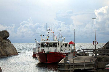
East Harbor with passengers ships Tuva and Stångskaer
Landsort became in 1985 a Environmental Protection Area. The island managed by the National Property Board since 2000. The northern part managed by the Archipelago Foundation.
Today, the pilot station manned by 10 boatmen. There are 3 boatmen who work each week around the clock.
Södertälje VTS (Vessel Traffic Service) is receiving pilot orders and monitors the fairways.
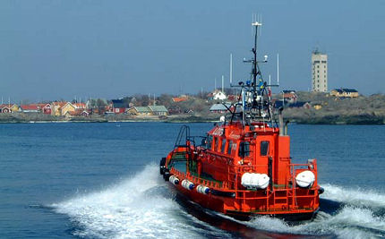
PILOT BOAT 111 towards Västerhamn
Ships have pilots on board between Landsort, Stavsnäs, Nynäshamn, Stora Vika, Södertälje, Stockholm and lake Mälaren all ports.
Landsort - Köping is Sweden's longest piloted fairway, this fairway takes about 11-12 hours depending on the speed of the vessel.
Pilot change occurs when in Södertälje, and at Stavsnäs. It happens that vessels ordered the pilots to other places also, including to
Askö (Askö Laboratory is a marine field station outside Trosa) and Muskö naval base.
In addition to some 4000 pilotage assignments / year at Landsort involved piloting boats including in search and rescue missions.
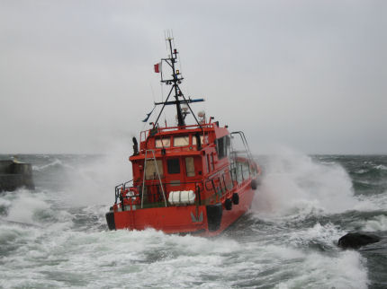
PILOT BOAT 747 on the way out from Västerhamn in west gale
Landsort Bird Station is a non-profit organization engaged in ringing, research on the island Landsort (Öja). Ringing in Landsort started on a small scale in the late 1970s, while the association was formed in 1988. Since then appropriated an old military barracks in Bredmar as bird station.
The island's strategic location in the outer sea is why it is a large concentration of migratory birds and resting here. In the autumn is delayed then the birds left on the island, because the climate is mild and there are plenty of insects and berries.
The island was discovered to be a good place for bird watching by ornithologists in the late 1940s.
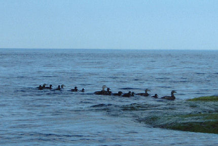
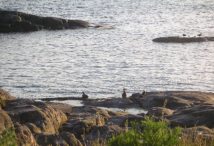
Eider
Read more about Landsort Bird Observatory here
Up
|